Weather Friday 20 November: more rain in the south, orange weather warning until 23:00, then sunshine
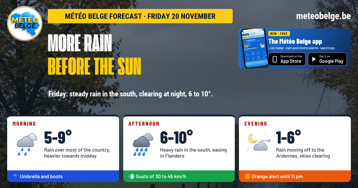
This Friday 20 November will be the last rainy day of the episode. Rain will fall relentlessly through the night, then become heavy and continuous in the afternoon across the south of the country, whilst it will ease in Flanders. In the evening, the sky will clear and temperatures will drop noticeably. 6 to 10°C, gusts of 30 to 45 km/h. The orange weather warning for rain remains active until 23:00 across Hainaut, Namur, Liège and Luxembourg. This weekend, expect sunshine and frosts.
- Night: relentless rain across the whole country, heaviest over the Ardennes, High Fens and Liège province
- Morning: grey and wet day, rain intensifies around midday
- Afternoon: heavy and continuous rain in the south, it weakens then stops in Flanders, the coast stays dry
- Evening: rain moves towards the Ardennes, the sky clears, 3 to 4°C
- Temperatures: 8 to 9°C at night, 6 to 10°C in the afternoon
- Wind: north-west to west, gusts of 30 to 45 km/h
- Rain: 10 to 25 mm in the south Friday, 30 to 50 mm with the night in orange zone
- Weather warning: orange rain until 23:00 in the south, yellow until 21:00 in the centre
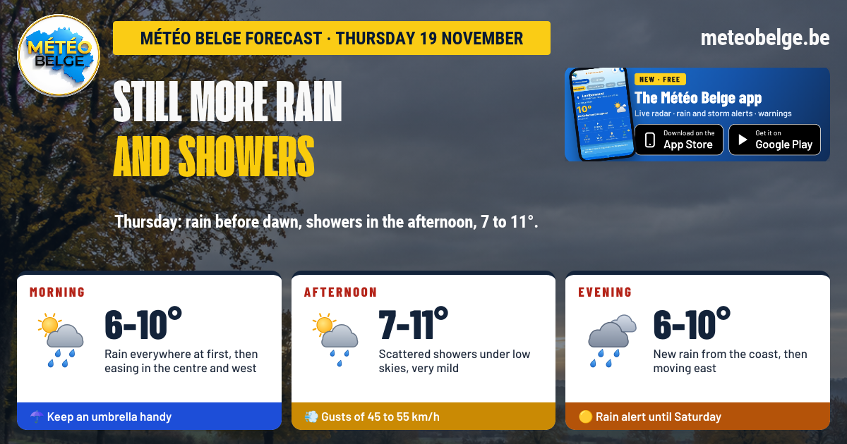
🌦️ This Thursday: rain, showers, then a new weather system
This Thursday was still very wet: morning rain gave way to showers in the afternoon, over ground that hasn't absorbed anything since Tuesday. In the evening, a new weather system, much more active, is moving in over Wallonia.
🌍 The situation: one last weather system before the high pressure builds in
A low pressure system centred over the North Sea is directing a warm and humid south-westerly flow towards Belgium. An active weather system is moving in over the country and bringing sustained rain, heaviest over Wallonia. It will then be swept away by cold and dry air coming from the north-west, and a high pressure system will bring back the sun this weekend, with morning frosts and fog in the valleys.
🌧️ Friday 20 November: more rain before the sun
🌙 This Thursday evening: rain moving in
Rain will move in steadily across Wallonia and intensify as the hours pass, heaviest over the Ardennes and the High Fens. It will also reach Flanders, Brussels and the Campine, though more lightly, whilst the coast remains mostly spared. Around 21:00-22:00: 6°C on the High Fens, 8°C on the coast and in Flanders, 9 to 10°C elsewhere.
🌌 During the night: relentless rain
Rain will fall relentlessly across the whole territory, with the heaviest amounts over the Ardennes, the High Fens and the province of Liège. Elsewhere, it will be more moderate, with short calmer spells in Flanders. Mist on the coast and in the Campine, patchy fog over the Ardennes peaks. Mild overnight lows: 5°C on the High Fens, 8 to 9°C everywhere else.
🌅 Friday morning: grey and wet
The day will start with rain affecting most of the country and picking up in intensity towards midday, particularly over the Ardennes and the High Fens. The coast and western Flanders will receive only a few drops. Mist and grey skies will cover the plain until mid-morning. At sunrise: 5°C on the High Fens, 8 to 9°C elsewhere.
🌧️ Friday afternoon: heavy rain in the south
Rain will become abundant and continuous over the southern half of the country, somewhat heavier in Entre-Sambre-et-Meuse. It will also affect Hainaut, Walloon Brabant, Flemish Brabant and Brussels, whilst in Flanders and the Campine it will ease then stop. The coast will remain dry, under skies that will start to clear. Highs: 6°C on the High Fens, 7 to 9°C in the Antwerp region, the Botte du Hainaut, Famenne and Gaume, 10°C elsewhere.
🌆 Friday evening: the skies open up
The rain will move slowly away towards the south-east, lingering for a few more hours over the Gaume et l'the ArdennesElsewhere, the sky will open up widely and the air will will cool down sharply : 1°C on the High Fens, 3 à 4°C Almost everywhere. Patches of fog may form on the high ground in the south.
💨 Wind and rain
The wind will blow from north-west to westI'm ready to translate French text to British English for Météo Belge. Please provide the text you'd like me to translate. 30 à 45 km/hI need more context to translate this text accurately. Could you please provide the complete sentence or phrase that includes ", jusqu'à"? 50 km/h in Gaumé. Throughout Friday, we're expecting 3 à 9 mm in Flanders, in Brussels and in Limburg, 10 à 20 mm over Hainaut, the Namur region, the Liège region and Gaume, and 20 à 25 mm in the Famenne and over the High Fens. With the overnight rain, that would make 30 à 50 mm In the orange zone, locally 60 mm on the summits. These quantities remain approximate.
The orange weather warning for rain is active on Météo Belge until Friday 23:00 over Hainaut (excluding Picardy Wallonia) and the provinces of Namur, Liège and Luxembourg. The yellow weather warning runs until Friday 21:00 over Walloon Brabant, Hageland, Limbourg and Picardy Wallonia. On saturated ground, local flooding, flooded roads and river floods are possible. Never cross a flooded road and keep your distance from riverbanks. Find the map and details by town on meteobelge.be.
Behind the weather system, the wind shifts to the north-west and brings down much colder and drier air. On Saturday, an anticyclone settles over our regions: the sky clears, and clear, calm nights allow heat from the ground to escape into space. This is what brings frost and fog in the early morning, especially in the valleys.
🌡️ Forecast temperatures for Friday in the main towns
| Town | Minimum | Maximum | Sky and rain | Gusts (day) | Rain (day) |
| Brussels | 9°C | 10°C | Rain in the morning and afternoon, clearing in the evening | 40 km/h | 4,8 mm |
| Antwerp | 8°C | 8°C | Rain in the morning, then cloudy, clear skies in the evening | 25 km/h | 8,7 mm |
| Ghent | 8°C | 10°C | A few drops overnight, cloudy, clearing in the evening | 30 km/h | 2,7 mm |
| Ostend | 8°C | 10°C | A few drops in the morning, then dry, clearing | 35 km/h | 3,3 mm |
| Liège | 9°C | 10°C | Rain for most of the day, skies clearing in the evening | 40 km/h | 14,1 mm |
| Namur | 9°C | 10°C | Heavy rain, then clearing in the evening | 40 km/h | 12,3 mm |
| Charleroi | 9°C | 10°C | Heavy rain throughout the day, clearing in the evening | 45 km/h | 13,8 mm |
| Mons | 9°C | 10°C | Rain in the morning and afternoon, clearing in the evening | 45 km/h | 10,3 mm |
| Tournai | 9°C | 10°C | Light rain then showers, clearing in the evening | 40 km/h | 6,0 mm |
| Hasselt | 9°C | 9°C | Showers, then clear skies in the evening | 40 km/h | 6,2 mm |
| Marche-en-Famenne | 8°C | 9°C | Heavy rain, persistent cloud in the evening | 45 km/h | 20,9 mm |
| Virton | 8°C | 9°C | Continuous rain until evening | 50 km/h | 15,7 mm |
| Butgenbach | 5°C | 6°C | Heavy rain and mist, late clearing | 50 km/h | 27,4 mm |
📅 What's next? Sunshine, frosts and fog
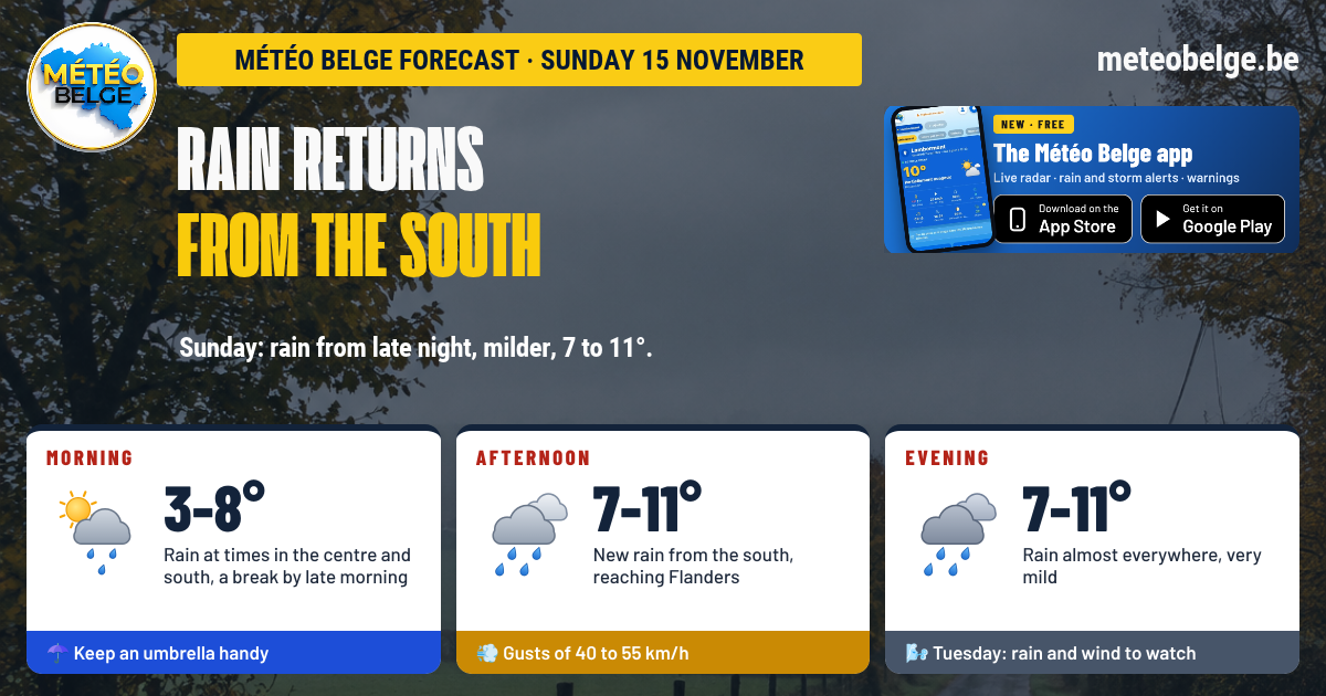
Saturday 21 November: ground frost, then brilliant sunshine
Under a clear sky, cold would set in during the night, with ground frost in the valley bottoms of the Ardennes, Famenne and Condroz, and a few banks of fog at daybreak. Then brilliant sunshine would shine across the whole country, in cold and dry air. Minimums of 0 to 3°C (-1°C on the High Fens), maximums of 7 to 9°C.
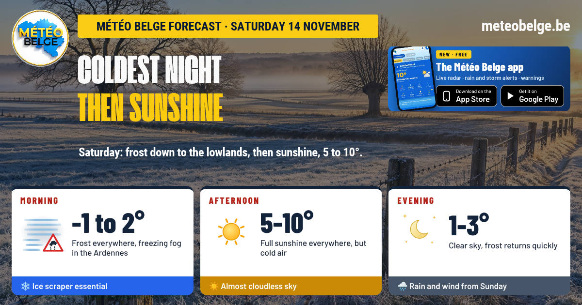
Sunday 22 November: frost and hazy sunshine
Frost would grip much of the country, more marked in the Campine, Limburg, Famenne and the Ardennes, with rime on cars. The sun should contend with a veil of high cloud, thicker in the south, with a light north-easterly breeze. Minimums of -2 to 1°C, maximums of 5 to 7°C.
Monday 23 November: fog then sunshine
Fog would develop across the plains and valleys towards the end of the night, sometimes rime, particularly in the Sambre-et-Meuse valley, the Condroz and Limburg. It would clear slowly before noon, giving way to sunshine almost everywhere. Lows of -2 to 1°C, highs of 4 to 6°C.
| Day | Weather | Temperatures (min / max) | Wind |
| Saturday 21 | ☀️ Ground frost then bright sunshine | 0 to 3°C / 7 to 9°C | South, gusts of 10 to 20 km/h |
| Sunday 22 | ❄️ Frost, hazy sun | -2 to 1°C / 5 to 7°C | North-east, gusts of 25 to 35 km/h |
| Monday 23 | 🌫️ Rime fog then sunshine | -2 to 1°C / 4 to 6°C | South, gusts of 15 to 25 km/h |
- Never cross a flooded road, whether on foot or by car
- Keep your distance from riverbanks and waterways, especially in the Ardennes and along the Meuse and Vesdre
- Drive carefully, with rain, puddles and reduced visibility
- This weekend, get out your ice scraper and protect sensitive plants from frost
Reliability is good for Friday's rain and its clearing in the evening. Exact amounts remain more uncertain: they could be somewhat heavier over an area stretching from Hainaut to the Ardennes. The return of sunshine and frosts this weekend is well confirmed, whilst the extent of Monday's fog remains to be clarified.
Receive alerts for your town, follow the rain live on the radar and check the forecast hour by hour.
🍏 App Store🤖 Google Play❓ Frequently asked questions
Will it rain this Friday 20 November?
Yes. Rain will fall throughout the night and for much of the day, with heavy and continuous rainfall over the south of the country in the afternoon. It will stop in Flanders over the course of the afternoon, then move away towards the Ardennes in the evening.
When does the rain stop?
From the afternoon in Flanders and on the coast, in the evening in the centre and in Hainault, and late in the evening over Gaume and the Ardennes.
How long does the orange weather warning last?
An orange rain weather warning is active on Météo Belge until Friday 23:00 on Hainaut (outside Picardy Wallonia), Namur, Liège and Luxembourg. A yellow weather warning runs until 21:00 on Walloon Brabant, Hageland, Limburg and Picardy Wallonia.
What temperature on Friday?
8 to 9°C at night, 6 to 10°C in the afternoon, then 3 to 4°C in the evening, when the sky will clear.
Will it freeze this weekend?
Yes. Ground frost is expected Saturday morning in the southern valleys, then more widespread frost Sunday and Monday morning, from -2 to 1°C, with occasionally hoar frost on Monday.
Forecast established by Michaël Vincent, Météo Belge.