Weather Saturday 14 November: the coldest night of autumn, then bright sunshine
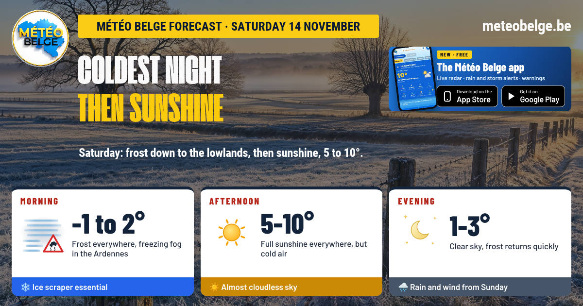
Under an anticyclone, the night from Friday to Saturday will be the coldest of autumn so far, with frost down to low-lying areas: -2 to -4°C in the Botte du Hainaut, and down to -1 or -2°C in Brussels and Hainaut. This Saturday 14 November will begin under frost, with rime on the Ardennes, then glorious sunshine will shine across the country, in cold air: 5 to 10°C. From Sunday afternoon onwards, rain and wind will return.
- Night: frost almost everywhere, hoar frost down to lower ground, freezing fog over the Ardennes and High Fens
- Morning: countryside blanketed in white, ice scraper essential, stubborn fog from the Condroz to Gaume: caution on minor roads
- Afternoon: plenty of sunshine everywhere, a few low clouds possible for a while over the Ardennes plateaus
- Evening: clear skies, frost returns quickly
- Temperatures: -4 to 0°C when you wake up, 5 to 10°C in the afternoon
- Wind: light from the south-east, gusts of 10 to 30 km/h
🌤️ This Friday: cool, between sunny spells and showers
This Friday started off quite cold, with 1 to 3°C at wake-up time in Brussels, Charleroi, Liège and Antwerp, and even a spot of frost on car windscreens in places. The day then alternated between clouds and lovely sunny spells, with a few passing showers in the afternoon for the unluckiest, and some more rain towards the end of the day over the capital. Maximum temperatures remained modest: 7 to 9°C almost everywhere.
🌍 The situation: an anticyclone bringing an icy night
An anticyclone is building over southern England and the North Sea. It brings us cold, calm air under clear skies: enough for us to experience the coldest night of autumn so far, with genuine frost down to the lowlands, something that hadn't happened yet this season. On Saturday, it will shift towards Germany and give us a bright day, before the arrival of a depression on Sunday from the North Sea, which will bring milder weather, rain and wind.
❄️ Saturday 14 November: frost at sunrise, then glorious sunshine
🌌 Tonight: freezing down to the plains and rime fog
The thermometer will dip below zero almost everywhere in still air, and frost will whiten the meadows right down to the plains, from Flanders to Hesbaye. Frost will be sharp in the hollows of Entre-Sambre-et-Meuse and the Famenne. Over the Ardennes and the High Fens, fog will thicken and turn rime. Patches of fog will also touch the Condroz and Gaume. Lows of -2 to -4°C in the Botte du Hainaut (not impossible to drop to -5°C), -2°C in western Hainaut, the Mons region and Charleroi, -1°C in Brussels, Flanders, the Namur region, Limburg, Gaume and the High Fens, 0°C at the coast, in the Antwerp region, in the Liège region and in Famenne.
🌅 Saturday morning: white countryside and fog in the south
The countryside will be white with frost at sunrise, and the ice scraper will come in handy before you take the car. Mist and grey skies may linger over the plains until mid-morning. From the Condroz to Gaume, passing through Entre-Sambre-et-Meuse, Famenne and the Ardennes, fog and low cloud will persist longer: take care on minor roads. The sun will gradually take over, sometimes a little more slowly locally, first over the coast. At sunrise: -1°C in Tournai and the Comines region, 0°C in the Mons region and Limburg, 1°C in Brussels, Flanders, the coast, Charleroi, Gaume and on the High Fens, 2°C in the Antwerp region, the Namur area, the Liège region, Famenne and the Botte du Hainaut.
☀️ Saturday afternoon: clear sunshine, but cold air
A bright, sunny day will light up the whole country, with an almost cloudless sky, from the polders to Hesbaye. On the Ardennes plateaux, a few low clouds may linger for a while. Despite this fine light, the air will remain fresh, and frankly cold at higher altitudes. It will be 5°C on the High Fens, 8°C on the coast, in Flanders, in Brussels, in Hainaut, in Famenne, in the Botte du Hainaut and in Gaume, 9°C in Charleroi, in the Namur region and Limburg, 10°C in the Liège region. UV index: 2, low.
🌙 Saturday evening: clear sky, frost returns quickly
From nightfall, the temperature will drop rapidly under a clear sky, and hoarfrost will form again in some rural areas. In the Ardennes, a few low clouds may return over the plateaux, whilst valley bottoms will quickly drop below freezing. Dry conditions everywhere. In the evening: 1°C on the High Fens, 2°C in most regions, 3°C in Brussels, in Tournai and in Famenne.
💨 Wind and air
The wind will remain weak, from the south-east, with gusts of 10 to 30 km/h, slightly stronger in the Ardennes. This calm, cold air traps pollution near the ground: air quality will be poor. For a walk, it's a lovely day, as long as you wrap up well.
At night, the ground loses its heat by radiating it into space. When the sky is overcast, clouds send some of that heat back, like a blanket. Under a clear sky and with no wind, nothing holds it back: the air near the ground cools very quickly and, being heavier, accumulates in valley bottoms. That's why the valleys of Entre-Sambre-et-Meuse and Famenne are often much colder than nearby towns or higher ground during these anticyclone nights.
🌡️ Forecast temperatures Saturday in major towns
| Town | Minimum | Maximum | Sky and rain | Gusts (day) | Rain (day) |
| Brussels | -1°C | 8°C | Frost, then bright sunshine | 20 km/h | 0,0 mm |
| Antwerp | 0°C | 8°C | Frost, then bright sunshine | 20 km/h | 0,0 mm |
| Ghent | -1°C | 8°C | Frost, then bright sunshine | 20 km/h | 0,0 mm |
| Ostend | 0°C | 8°C | Sunshine from the morning | 20 km/h | 0,0 mm |
| Liège | 0°C | 10°C | Morning mist, then sunshine | 20 km/h | 0,0 mm |
| Namur | -1°C | 9°C | Morning overcast, then sunshine | 20 km/h | 0,0 mm |
| Charleroi | -2°C | 9°C | Frost and mist, then sunshine | 20 km/h | 0,0 mm |
| Mons | -2°C | 8°C | Frost, then bright sunshine | 15 km/h | 0,0 mm |
| Tournai | -2°C | 8°C | Frost, then bright sunshine | 15 km/h | 0,0 mm |
| Hasselt | -1°C | 9°C | Frost, then sunshine | 15 km/h | 0,0 mm |
| Marche-en-Famenne | 0°C | 8°C | Morning fog, then sunshine | 30 km/h | 0,0 mm |
| Virton | -1°C | 8°C | Morning fog, then sunshine | 30 km/h | 0,0 mm |
| Butgenbach | -1°C | 5°C | Hoar frost fog, then hazy sunshine | 30 km/h | 0,0 mm |
📅 What's next? Rain and wind, especially on Tuesday
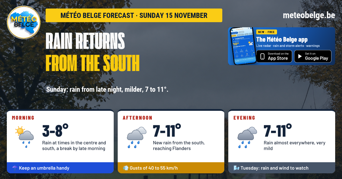
Sunday 15 November: rain and southerly wind
After a cold start to the night, the sky would become overcast from the south-west. Rain would reach the coast and the west of Hainaut in the early afternoon, then almost the entire country by evening, sometimes heavy over the Gaume and the Ardennes. Southerly wind would strengthen, with gusts of 55 to 70 km/h. Lows of -1 to 4°C, highs of 8 to 11°C.
Monday 16 November: a lull between two spells of rain
Showers at daybreak, especially in the east, then a calmer spell with more widespread sunny spells on the coast and the north-west. Rain would return from the south in the evening. South-westerly wind, gusts of 45 to 60 km/h. Lows of 3 to 8°C, highs of 6 to 10°C.
Tuesday 17 November: heavy rain and fairly strong wind
A deeper low pressure system would pass near the south of England. Heavy rain across the country, with accumulations of 15 to 30 mm, and a fairly strong south-westerly wind, with gusts of 70 to 85 km/h, even a little higher in some places. It would be very mild, 10 to 14°C. A situation to keep an eye on, which remains to be confirmed in the coming days.
| Day | Weather | Temperatures (min / max) | Wind |
| Sunday 15 | 🌧️ Milder and windy, rain from the afternoon in the west, sometimes heavy in the south this evening | -1 to 4°C / 8 to 11°C | South, gusts of 55 to 70 km/h |
| Monday 16 | ⛅ Showers at dawn, a lull and sunny spells, rain returning this evening | 3 to 8°C / 6 to 10°C | South-west, gusts of 45 to 60 km/h |
| Tuesday 17 | 🌧️ Heavy rain (15 to 30 mm), very mild, to be confirmed | 4 to 8°C / 10 to 14°C | South-west, gusts of 70 to 85 km/h |
- Allow yourself a few minutes to scrape your windscreen when you wake up
- Watch out for frost patches on minor roads and bridges, especially in the south
- Hats and gloves to enjoy the sunshine: the air will stay cold throughout the day
- Secure loose items in your garden: Saturday is the ideal day before the wind on Sunday and Tuesday
The reliability is very good for the frost and sunshine on Saturday. The exact intensity of the frost remains more uncertain in valley bottoms, where it can be considerably colder than expected. For Sunday, the arrival of rain and wind is well predicted, but the time can still vary. Tuesday is still some way off: heavy rain and fairly strong wind are likely, but their strength and the regions most affected remain to be confirmed.
Frost at dawn, rain and wind from Sunday onwards: follow it all from home. Hourly forecasts for your town, live radar, alerts and weather warnings.
🍏 App Store🤖 Google Play❓ Frequently asked questions
Will it freeze this Saturday, 14 November?
Yes. The night from Friday to Saturday will be the coldest of the autumn so far, with frost almost everywhere: -2 to -4°C in the Botte du Hainaut, -2 to -1°C in Hainaut, Brussels and Flanders, around 0°C on the coast and in the Liège region. Frost will blanket the grasslands down to the plains.
Will the weather be nice on Saturday?
Yes, after the frost and morning fog, bright sunshine will shine across the country in the afternoon. Fog will persist longer from the Condroz to Gaume and over the Ardennes.
What temperature on Saturday afternoon?
5 to 10°C: 5°C on the High Fens, 8°C in most regions, up to 10°C in the Liège area.
When does the rain return?
Sunday afternoon, from the coast and the west of Hainaut, then across almost the whole country in the evening, with a fairly strong south wind. Tuesday is shaping up to be the wettest day, to be confirmed.
Forecast established by Michaël Vincent, Météo Belge.