Weather on Thursday 19 November: continuous rain and showers, yellow weather warning until Saturday
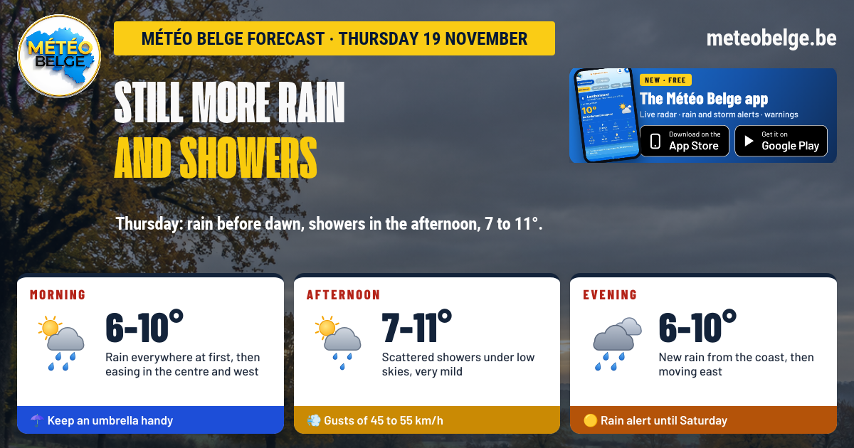
After a wet Wednesday, the lull will be short-lived: rain returns before dawn on Thursday 19 November, from the south-west, and spreads across the country. It will clear in the morning to make way for scattered showers in the afternoon, before more rain in the evening from the coast. It will be very mild for the season, 7 to 11°C, with gusts of 45 to 55 km/h. Yellow weather warning for rain remains in force until Saturday, over saturated ground.
- Night: calm until around 03:00, then rain from the south-west across the whole country before dawn, a clap of thunder possible in the west
- Morning: rain everywhere when you wake up, which clears from the centre and west, but persists in the east
- Afternoon: scattered showers under a low sky, more frequent on the coast, in Flanders and over the Ardennes
- Evening: further rain on the coast and in Flanders, then towards the east
- Temperatures: 6 to 9°C at night, 7 to 11°C in the afternoon
- Wind: from the south-west, gusts of 45 to 55 km/h
- Rain: 6 to 9 mm over most regions, 11 to 14 mm on the coast, in Gaume and over the High Fens
- Weather warning: yellow rain on Météo Belge until Saturday
🌧️ This Wednesday: another very wet day
This Wednesday brought more rain, then heavy showers at times across the board, over ground already saturated with water following the heavy rainfall on Tuesday. The wind remained noticeable. The last showers are easing off in the early evening over the Ardennes, Gaume, Liège province, the Campine and in places in Entre-Sambre-et-Meuse.
🌍 The situation: one weather system chasing another
The depression that brought us all that rain is slowly moving away towards the north-east, passing over the Netherlands. Behind it, a fresh and unstable westerly flow is still bringing a few showers, before a short calm spell this evening. But a new Atlantic weather system is arriving from the south-west as early as tonight, followed by showers on Thursday, then continuous rain on Friday. On Saturday, an anticyclone will finally bring cold, dry air, with sunshine and frosts.
🌧️ Thursday 19 November: more rain and showers
🌙 Wednesday evening: calm and still mild
After the last showers, the evening becomes calm, and the sky opens up in places on the plain, even though low clouds may linger near the coast. The High Fens and Gaume remain under a grey blanket. Around 21:00-22:00: 6°C on the High Fens, 8°C in the Botte du Hainaut, 9°C in Charleroi, Tournai, Famenne and Gaume, 10°C almost everywhere else.
🌌 During the night: rain returns from the south-west
Calm until around 03:00, the night will then see rain returning from the south-west and spreading across the whole country before dawn. It will be heaviest in Hainaut, Entre-Sambre-et-Meuse, Gaume, West Flanders and on the coast, with a possible thunderclap in the west. Over the Ardennes highlands, visibility will be reduced. Very mild lows: 6°C on the High Fens, 8°C in the Antwerp region, Limburg, the Comines area, the Botte du Hainaut and in Gaume, 9°C everywhere else.
🌅 Thursday morning: rain everywhere, then it clears
Present across the country at sunrise, the rain will gradually ease during the morning, first from the centre and west. It will be more persistent over the Ardennes, Liège province, Gaume, the Campine and Limburg, where totals will be most significant. Fog will shroud the Ardennes peaks. At sunrise: 6°C on the High Fens, 9°C in the Antwerp region, Limburg, the Botte du Hainaut, Famenne and Gaume, 10°C everywhere else.
🌦️ Thursday afternoon: scattered showers, very mild
Scattered showers will move across most regions under a low sky, more frequent near the coast, in Flanders and over the Ardennes. Between showers, the weather will remain grey, but it will be mild for November. Highs: 7°C on the High Fens, 9°C in the Botte du Hainaut, 10°C in Famenne and Gaume, 11°C everywhere else, from Flanders to the Liège region.
🌙 Thursday evening: more rain by the coast
A new rain band will move across the country in the evening, first affecting the coast and Flanders, then moving towards the centre, the Campine, Condroz, Famenne, Liège province, the Ardennes and Gaume. A brief thunderclap remains possible in the west, and mist will develop over the littoral. Mild conditions will persist: 6°C on the High Fens, 9 to 10°C almost everywhere.
💨 The wind and rain
South-westerly winds will gust at 45 to 55 km/h throughout the day, reaching 60 to 65 km/h occasionally in the morning around Antwerp. For rainfall, we expect 6 to 9 mm over most regions, and 11 to 14 mm over the littoral, in Gaume and on the High Fens. These amounts are approximate.
The yellow weather warning for rain remains active on Météo Belge until Saturday. After the rainfall on Tuesday and Wednesday, the ground is saturated: even a light shower runs off quickly, and significant puddles or small localised flooding remain possible, particularly Friday over the Ardennes and in Liège province. A further assessment will be made Thursday morning. Find the map and details by town on meteobelge.be.
Since Tuesday, Belgium has been in the path of Atlantic weather systems, driven by a fast westerly current at altitude. They follow one another at just a few hours' interval: barely has one rain area moved away than another arrives. Between them, cooler and unstable air brings showers. You'll have to wait until Saturday for an anticyclone to settle over our regions to stop this procession and bring back dry weather.
🌡️ Temperatures forecast for Thursday in the main towns
| Town | Minimum | Maximum | Sky and rain | Gusts (daytime) | Rain (daytime) |
| Brussels | 9°C | 11°C | Rain at sunrise, showers in the afternoon, rain in the evening | 55 km/h | 6.8 mm |
| Antwerp | 8°C | 11°C | Rain at sunrise, gusts in the morning, showers afterwards | 65 km/h | 7.7 mm |
| Ghent | 9°C | 11°C | Rain at sunrise, showers in the afternoon, rain in the evening | 50 km/h | 8.5 mm |
| Ostend | 9°C | 11°C | Rain before dawn, frequent showers, rain in the evening | 45 km/h | 11.3 mm |
| Liège | 9°C | 11°C | Persistent rain in the morning, showers, rain in the evening | 55 km/h | 6.9 mm |
| Namur | 9°C | 11°C | Rain at sunrise, scattered showers, rain in the evening | 50 km/h | 6.7 mm |
| Charleroi | 9°C | 11°C | Rain before dawn, scattered showers, rain in the evening | 50 km/h | 6.7 mm |
| Mons | 9°C | 11°C | Rain before dawn, scattered showers, rain in the evening | 50 km/h | 6.0 mm |
| Tournai | 9°C | 11°C | Rain before dawn, showers, rain in the evening | 50 km/h | 7.6 mm |
| Hasselt | 8°C | 11°C | Persistent rain in the morning, showers afterwards | 55 km/h | 8.6 mm |
| Marche-en-Famenne | 9°C | 10°C | Rain in the morning, showers, rain in the evening | 55 km/h | 7.2 mm |
| Virton | 8°C | 10°C | Sustained rain overnight and in the morning, showers | 50 km/h | 14.1 mm |
| Butgenbach | 6°C | 7°C | Rain and fog in the morning, showers, rain in the evening | 55 km/h | 11.5 mm |
📅 What's next? More rain on Friday, then it gets cold
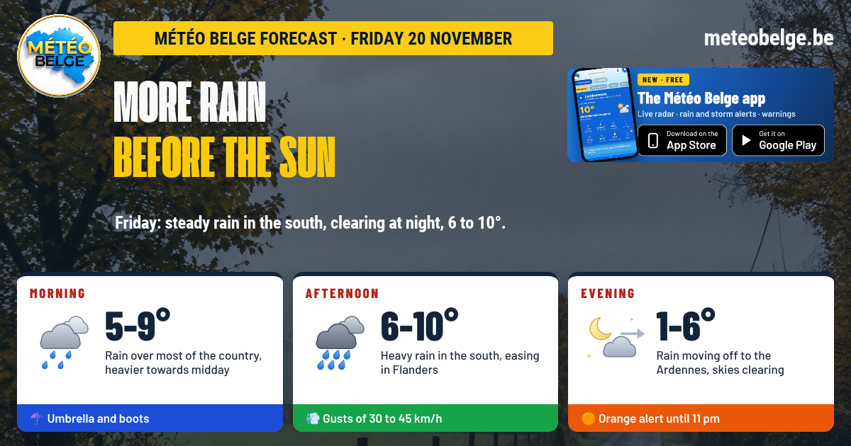
Friday 20 November: a day of continuous rain
Rain would settle over the whole country, continuous and sustained especially from midday to midnight, with the most rainfall over the Ardennes, Liège Province, Brussels, Walloon Brabant, Condroz and Entre-Sambre-et-Meuse. You could collect 1 to 5 mm at the coast and in Flanders, 10 to 14 mm in central areas and Hainaut, and 20 to 25 mm in Liège Province and over the High Fens. South-westerly wind, gusts of 35 to 45 km/h. Lows of 8 to 9°C (5°C over the High Fens), highs of 8 to 10°C.
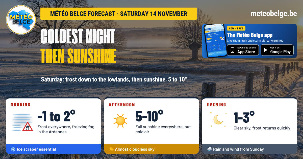
Saturday 21 November: ground frost, then brilliant sunshine
The last raindrops would leave the Ardennes shortly after midnight, then the sky would clear, and hoar frost would make its return late in the night. After mist and patches of fog when you wake up, bright sunshine would shine across Belgium, in dry and cool air. Lows of 0 to 4°C, highs of 7 to 9°C.
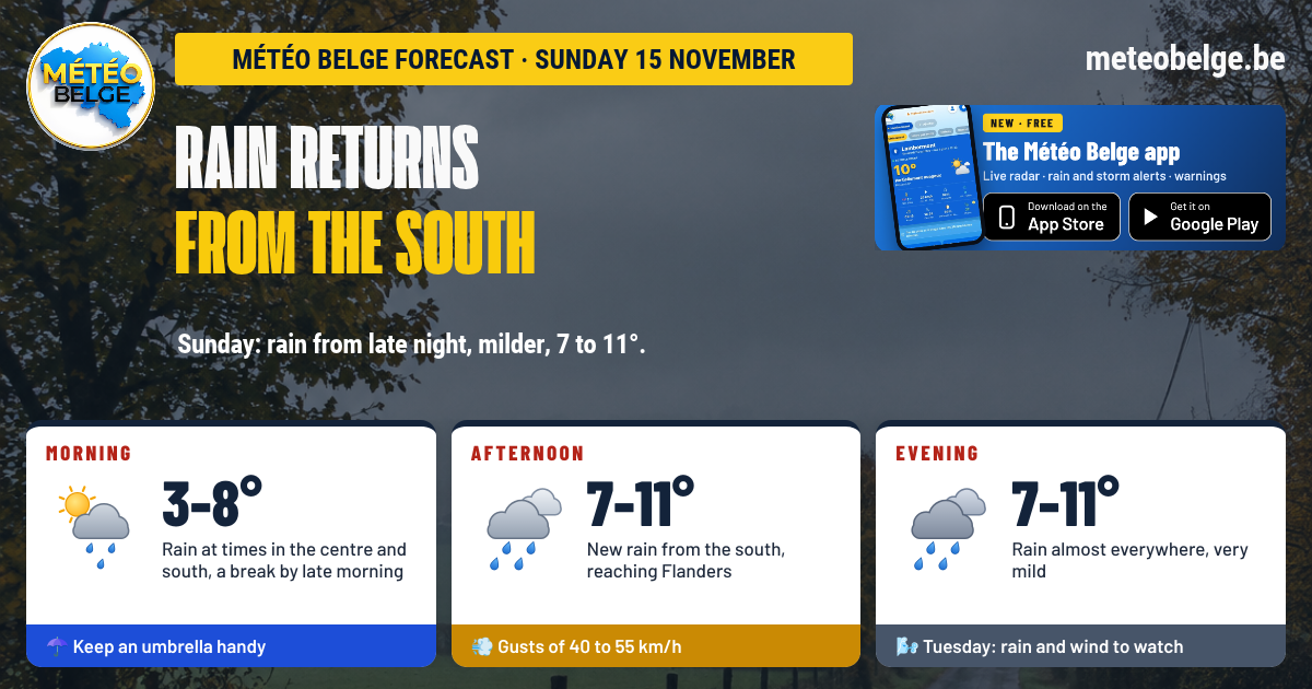
Sunday 22 November: cold and dry
Cold and calm night, with hoar frost in rural areas through to the Ardennes and a few patches of fog. Your ice scraper would be needed when you wake up, before a dry day under a pale sun, with a light north-easterly breeze. Only the Gaume could see a few drops. Lows of -1 to 2°C, highs of 5 to 7°C.
| Day | Weather | Temperatures (min / max) | Wind |
| Friday 20 | 🌧️ Continuous rain, up to 20 to 25 mm in the east | 8 to 9°C / 8 to 10°C | South-west, gusts of 35 to 45 km/h |
| Saturday 21 | ☀️ Ground frost then bright sunshine | 0 to 4°C / 7 to 9°C | West, gusts of 15 to 25 km/h |
| Sunday 22 | ❄️ Cold and dry, pale sunshine | -1 to 2°C / 5 to 7°C | North-east, gusts of 25 to 35 km/h |
- Be careful on wet roads early in the morning, with puddles and reduced visibility on higher ground
- Keep your umbrella within reach throughout the day
- The early afternoon will offer the best times to go outside, between showers
- Check that your gutters and drains are not blocked before Friday's rain
- This weekend, remember to protect sensitive plants from frost
Reliability is good for the return of rain before dawn and the afternoon showers. The exact time of arrival of the evening rain may still vary by an hour or two, and thunderstorms will remain isolated. For Friday, a continuous rainy day is quite likely, but the exact amounts and the regions with the most rainfall still need to be clarified. The return of cold weather and sunshine this weekend is confirmed.
What time will the rain arrive where you are? Follow it live on the radar, with hour-by-hour forecasts for your town, alerts and weather warnings.
🍏 App Store🤖 Google Play❓ Frequently asked questions
Will it rain on Thursday 19 November?
Yes. Rain returns before dawn across the country, withdrawing from the centre and west in the morning, then giving way to scattered showers in the afternoon. Fresh rain arrives in the evening from the coast and Flanders, then spreads east.
What time will the rain arrive?
The night will remain calm until around 03:00. Rain will then arrive from the south-west and cover the whole country before sunrise. Evening rain will arrive first at the coast and in Flanders, then towards the centre and east during the course of the evening.
Will there be thunderstorms?
A clap of thunder is possible in the west, especially overnight and in the evening, but it will remain isolated and brief.
What temperature on Thursday afternoon?
7 to 11°C: 7°C on the High Fens, 9 to 10°C in the Botte du Hainaut, in Famenne and in Gaume, 11°C almost everywhere else. It's mild for November.
How long does the rain weather warning last?
The yellow rain weather warning remains active on Météo Belge until Saturday. Friday will be the wettest day, especially over the Ardennes and in the province of Liège. A new analysis will be carried out Thursday morning.
When will dry weather return?
Saturday. The last drops would leave the Ardennes shortly after midnight, then bright sunshine would settle in, with ground frost on waking Saturday and Sunday.
Forecast prepared by Michaël Vincent, Météo Belge.